
Elizabeth's Guidebook
Hiking
This entry point to the Allegheny Trail 701 is appox 20 miles from Elkins. Put Glady, WV in your map app. At the section of the route where you will turn right onto Glady Rd there will be a restaurant/hotel called Alpine that sits on the left across from Glady Rd. Once you turn into Glady Rd the parking for this trail is appox 71/2 miles and is on the left side. You may want to screen shot a few picts of the map as you will lose cell service a few miles outside of Elkins and will not regain service until you return.
This is a moderate to difficult trail, I am told. I have not personally hiked this trail.
This is entrance point is part of section 4 of the trail. Please do your due diligence when planning hiking trips and enjoy our wonderful scenic area.
Alltrails.com, fs.usda.gov and purple lizard.com should be good sources for more information.
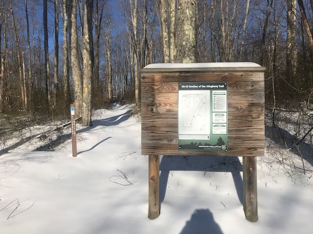
Allegheny Highlands Trail of WV
Allegheny Highlands Trail of WVThis entry point to the Allegheny Trail 701 is appox 20 miles from Elkins. Put Glady, WV in your map app. At the section of the route where you will turn right onto Glady Rd there will be a restaurant/hotel called Alpine that sits on the left across from Glady Rd. Once you turn into Glady Rd the parking for this trail is appox 71/2 miles and is on the left side. You may want to screen shot a few picts of the map as you will lose cell service a few miles outside of Elkins and will not regain service until you return.
This is a moderate to difficult trail, I am told. I have not personally hiked this trail.
This is entrance point is part of section 4 of the trail. Please do your due diligence when planning hiking trips and enjoy our wonderful scenic area.
Alltrails.com, fs.usda.gov and purple lizard.com should be good sources for more information.
This is the McCray Run section of the Laurel Fork Wilderness Trail. It is appox 16-17 miles from Elkins. Put Glady, WV in your map app. At the section of the route where you will turn right onto Glady Rd there will be a restaurant/hotel called Alpine that sits on the left across from Glady Rd. Once you turn into Glady Rd the trail is appox 41/2 miles and is on the left side. Parking is very limited, just along the side of the road. You may want to screen shot a few picts of the map as you will lose cell service a few miles outside of Elkins and will not regain service until you return.
This is a moderate to difficult trail, I am told. I have not personally hiked this trail. I am told this is a moderate to difficult trail, I have not hiked this trail. Please do your due diligence when planning hiking trips and enjoy our wonderful scenic area.
Alltrails.com, fs.usda.gov and purplelizard.com should be good sources for more information.
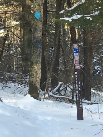
Laurel Fork Trail
Laurel Fork TrailThis is the McCray Run section of the Laurel Fork Wilderness Trail. It is appox 16-17 miles from Elkins. Put Glady, WV in your map app. At the section of the route where you will turn right onto Glady Rd there will be a restaurant/hotel called Alpine that sits on the left across from Glady Rd. Once you turn into Glady Rd the trail is appox 41/2 miles and is on the left side. Parking is very limited, just along the side of the road. You may want to screen shot a few picts of the map as you will lose cell service a few miles outside of Elkins and will not regain service until you return.
This is a moderate to difficult trail, I am told. I have not personally hiked this trail. I am told this is a moderate to difficult trail, I have not hiked this trail. Please do your due diligence when planning hiking trips and enjoy our wonderful scenic area.
Alltrails.com, fs.usda.gov and purplelizard.com should be good sources for more information.